
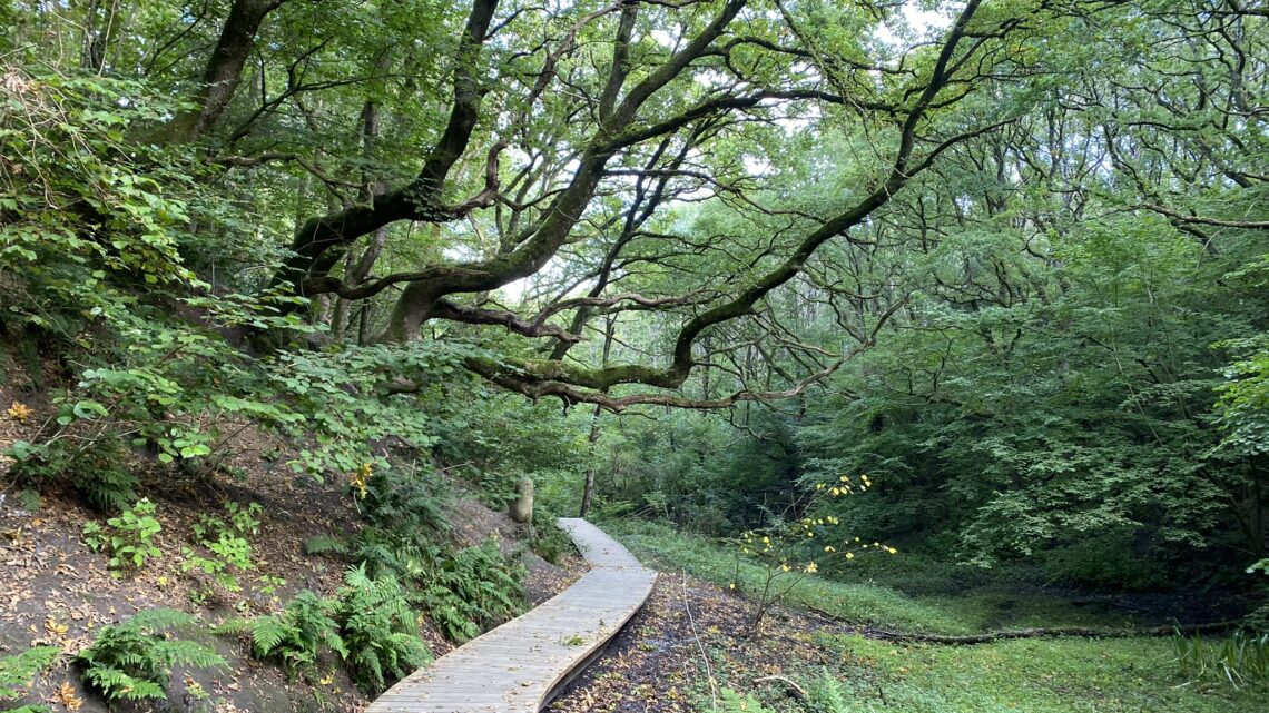
Tranum Fosdal, 11 km
If you are in the area north of the Limfjord, the Tranum Fosdal hiking route is a must. The route has also been certified as a "Premium" hiking route by the German Hiking Institute (Deutsches Wanderinstitut)—an honor bestowed upon only four hiking routes in Denmark.
We set our GPS to Strandvejen 37, 9460 Brovst and parked the car in the relatively large parking lot at the entrance to Tranum Fosdal. We arrived early, as we wanted to do the walk before too many other people showed up.
The route is well-marked with blue-green pictograms, and there is only one point where we have to make a choice. We start by walking through Langdal Plantation, a beautiful forest with plenty to see.


We have walked little more than two kilometers when we reach an open area in the forest where, from Bavnehøj—which, at 83 meters above sea level, is the highest point in Jammerdal—we have a magnificent view of the sea at Tranum Strand.


After just under 3 kilometers, there is an option to turn right onto the red route, but we keep left and continue towards Ingeborg Bakker, which connects Fosdalen and Langdalen. There is a wonderful view of the heathlands here, and the hills offer great vantage points.


We now head towards Fosdalen; as we emerge from the forest into the clearing, Lerup Church is on our left. We turn right and follow the edge of the woods, where picnic tables are set up, allowing us to enjoy some coffee before entering Fosdalen itself. We enter Fosdalen, a valley that cuts down through the Lien ridge. We keep to the left (the path to the right is certainly an option, but it does not take you through the valley), and we are immediately struck by the sensation of entering a valley where the vegetation blocks out the sun.


As we venture deeper into the valley, the forest around us grows denser, and we truly get the sense of walking through a vast valley. We are captivated, and when we compare this to the closest we have come to such an experience, it has to be our trip to The Abyss at Vissenbjerg, which is also a valley formed by the powerful forces of the Ice Age—albeit on a somewhat smaller scale. The trail was beautifully constructed by local volunteers. We also pass Vor Frue Kilde (Our Lady’s Spring), said to be an ancient holy spring visited for years by the sick on the Virgin Mary’s birthday, September 8th—though we, unfortunately, arrived on September 19th 🙂


After a truly fantastic experience hiking just over a kilometer through the valley, the route heads upwards again, and we are now walking along the top of Lien, which is Denmark’s longest inland coastal cliff. Lien stretches 6–7 kilometers from Svinkløv to Tranum and reaches a height of 66 meters in places. It was formed during the Ice Age, when massive bodies of ice pushed up from the sea, driving the earth before them to create the cliff. The terrain is quite hilly but offers fantastic opportunities for taking beautiful photos.


Between the 7- and 8-kilometer marks, we enter Langdalen, where we once again clearly sense how meltwater helped shape the landscape many years ago.


We now move a short distance away from the edge of Lien and walk through the woods, yet frequently make brief detours to the edge, where the beautiful view can be enjoyed from strategically placed seating areas.


Although we are now entering a landscape that most closely resembles a plantation or heath, we still get to experience walking along the edge of the Lien escarpment, enjoying a moment of relaxation and taking in a truly superb view. It is remarkable that, despite walking at an elevation of over 50 meters, we are treading on sand—a testament to how the ice pushed the sand upwards. The final leg of the walk back to the car follows a forest track through the beautiful woods.


The hike is just over 11 kilometers long and is one of the most beautiful we have ever done – we can certainly understand why it has been named one of the top four in Denmark.
Click on the map below and it will open in Google Maps. From here, you can follow the route as you are hiking.
