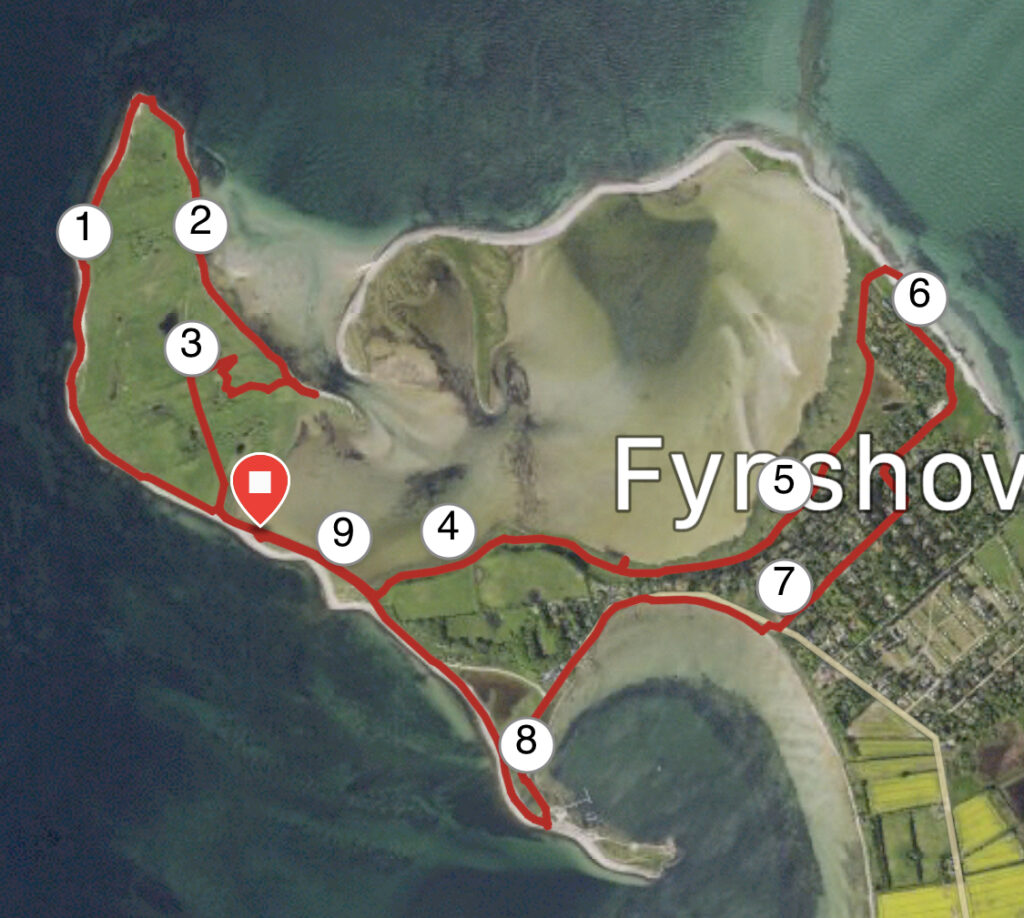
Fyns Hoved. 10 kilometres.
Fyns Hoved is always worth a trip.
On the north-eastern part of Funen is Fyns Hoved. The trip from Munkebo up to Fyns Hoved is incredibly beautiful with views of the water wherever you look. However, it is quite a long drive if you just want to stroll the good 3 km around Funen Hoved.
You can extend your hike by following our description and make your hike almost 10 kilometres long.
Drive as far towards Fyns Hoved as you can and park and start your hike. We took the trip all the way down along the water. You only need to do this if you have strong ankles and are good at walking on rocks. On the other hand, you will experience Funen Hoved's steep slopes and see how the sea, weather and wind slowly eat away further in. There will always be shelter at one point or another around the tip. Whether you take the trip by the coast or follow the well-visited paths, you will get some great subjects for photos. You will find the perfect Photoshoot on the way back from the tip, where you look towards the mainland.
We start our walk by turning left so that we have the steep cliffs on our right and the sea on our left. The steep cliffs with deposits of large stones at the top tell their very own story about how the end of the ice age has dragged stones into the meltwater close to a fortune teller's gate. Almost at the tip, we pass Baesbanke, which is the highest point on Fyns Hoved, and where there is a fantastic view back over the whole of Fyns Hoved.


If there is strength and energy for it, it is recommended to climb up the cliff at the very top. There is a bench at the top where you can enjoy your packed lunch or brought coffee with the most beautiful view.
There is also the possibility of a bit of history, as there are still traces of the German installations from World War II, where barracks, anti-aircraft guns and coastal defense guns were erected to control the entrance to the Great Belt.
We continue our trip along the beach, where there are still quite a few stones to be climbed. Good for training ankles.


You can, however, choose a slightly easier route, by walking just 10-20 meters into the country, where there is a nice path. We continue, but are stopped by conservation signs, which is why we go a little backwards and across the area towards the center of the island, until we hit the large dirt road that leads around the entire island. We pass sheepfolds and dense low vegetation until we come back to the long, narrow stretch from where we started. We go left the first time it is possible, so we now walk with the shallow water in "Fællesstrand" on our left. If you first go up the stairs, you get a fantastic view of Fyns Hoved.
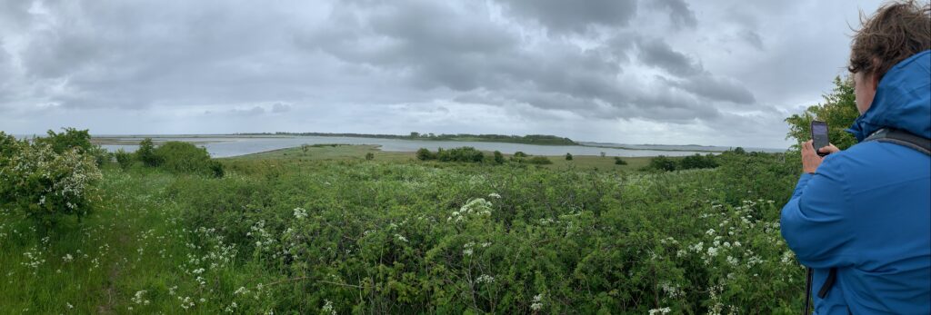
Go down again and continue around the coast along the Horseklint road. Here you will experience the shallow area called Fællesstrand, where waders and ducks thrive, and where on a good day you can see both kestrels and grebes.
We are now passing through an area with salt marshes, which is characterized by the fact that it is occasionally flooded with seawater, which is why plants and vegetation can tolerate salt.

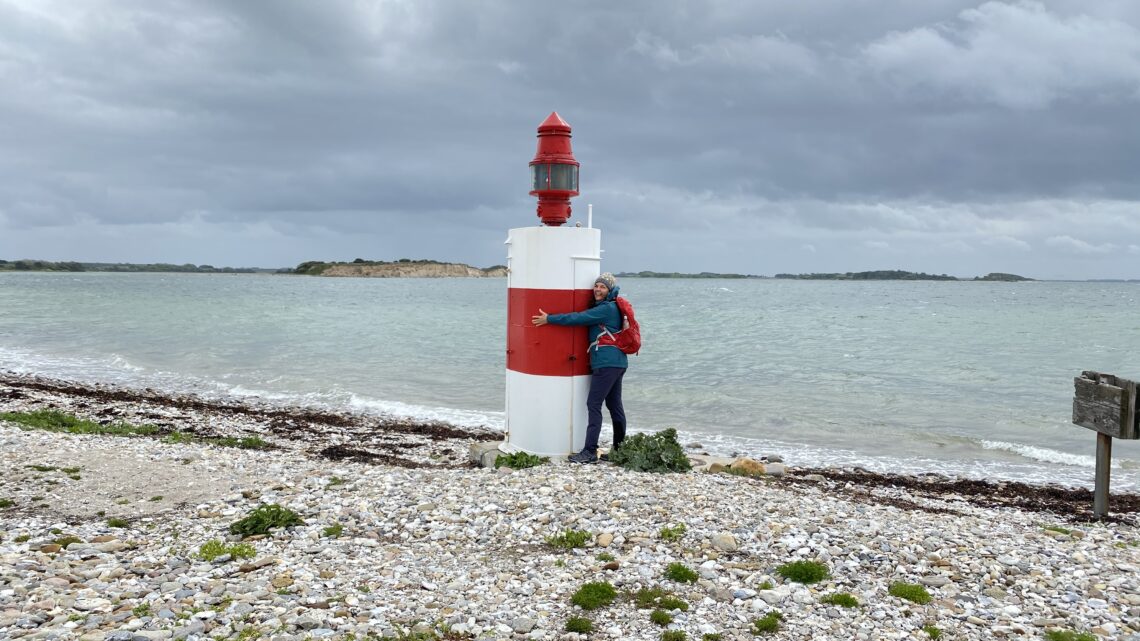
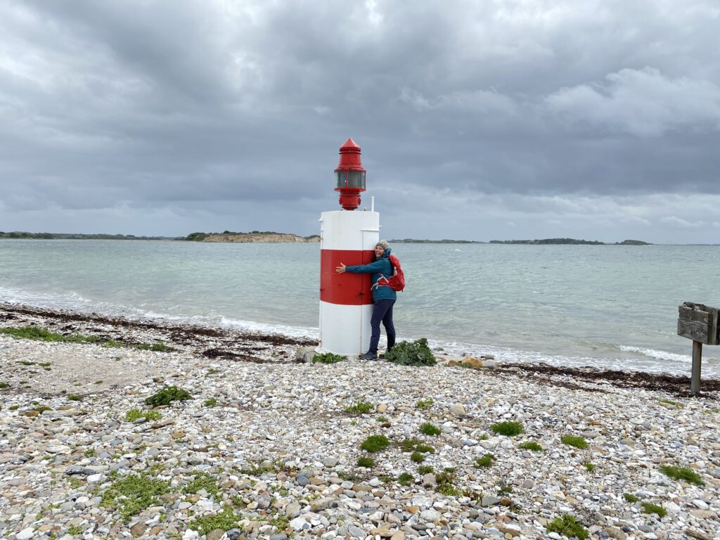
We continue to the end of the summer house area, where Horseklint continues to the left. At low tide, you can easily walk far along Horseklint, which is a rock and gravel cliff that forms the shallow lagoon called Fællesstrand. However, we choose to go right along the beach and after a good 100 meters we go right along a path and onto Sandvejen, where we turn left. We follow Sandvejen out onto Sømærkevej and come out onto Fynshovedvej, where we go right and immediately left if possible down to the beach at Korshavn. We follow the beach for a bit, but choose to go up the road. We keep to the left to get out to the lowest and thinnest lighthouse we have seen. It was standing all alone and looked like it could use a hug 🙂
From here we return to the car along the coast.
The hike is about 10 kilometres long.
If you want to read more about what Kerteminde has to offer, go to Visitkerteminde.dk
Click on the map below and it will open in Google Maps. From here, you can follow the route as you are hiking.